Post by Markoz on Mar 15th, 2011 at 2:04am
Hi CoolP.
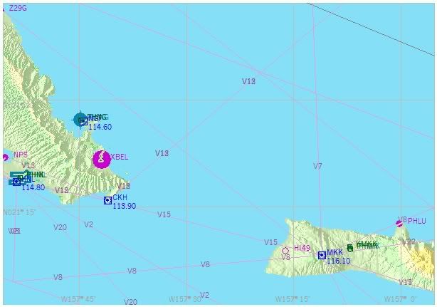
On my flight plan from Seattle to Honolulu, I use Jetway A331 (SEDAR to ZIGIE), V7 (ZIGIE to JOELE) and V13 (JOELE to CHK). So I don't use VOR CHK to align my INS because it is on the flight plan (remember that I am using a single INS). I try to use either the MKK or NGF VOR as neither of these are used as waypoints on the flight plan. Once I come into range of NGF a few minutes before MKK (followed by CHK a few minutes later), I start the alignment process, making sure not to initiate it until CHK has come into range (I'm not sure if that helps or not with it being part of the flight plan). It is this part, from Operations Manual, page 15, that gets me confused:
CDU Keyboard Push DME ID Number
Check that DME ID number appears on TO indicator.
as I'm not 100% sure what that means. When I get to the ID's, I go through them looking for either of the VORs I have selected to do the alignment with, and look for one with the same co-ordinates. None match. I saw one that its Longitude was close but the Latitude was in the Southern Hemisphere and not Northern Hemisphere. This left me with no VOR to use for the alignment process. I eventually tried one that was listed that had Degrees N and W, but it didn't align.
I use the FS Map (ALT > WORLD > MAP), before I leave, and obtained the Latitude and Longitude and height above sea level for both of them. Here is an image to show the area I'm using to get the VOR info from:
Am I the only one wondering to which statement he's referring to with "oh yes"? :-?
It had me wondering too. ;D
Mark